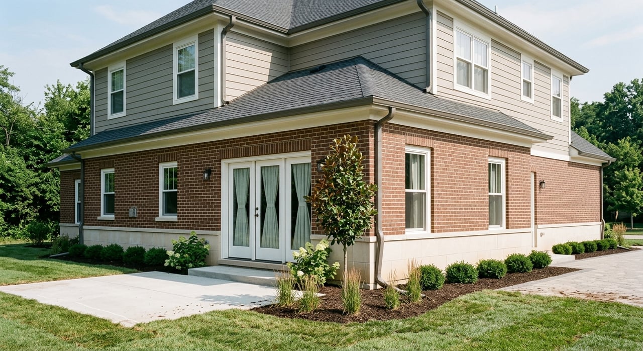
Ever scroll Monroe County listings and notice “mountain view” popping up everywhere? It sounds wonderful, but not all views are the same. In East Tennessee, terrain, trees, and seasons can change what you actually see from the porch. If you know how to read these terms and verify them in person, you can avoid surprises and buy with confidence.
This guide breaks down common view labels, how they affect value, and practical steps to confirm what you’ll see year-round. You’ll also get a checklist and key questions to ask before you write an offer. Let’s dive in.
What “mountain view” means in Monroe County
In Monroe County, most “mountain views” show Appalachian ridgelines rather than bare peaks. You’ll often see rolling, wooded ridges in the middle or far distance, sometimes with valleys or water in the foreground. Elevation, slope, tree cover, and the time of year all shape what you see.
Ridge view vs. mountain view
- Ridge view usually highlights one dominant nearby ridge that feels close and more prominent.
- Mountain view may include nearby ridges or a distant horizon of multiple ridgelines. It can feel broader but sometimes less immediate.
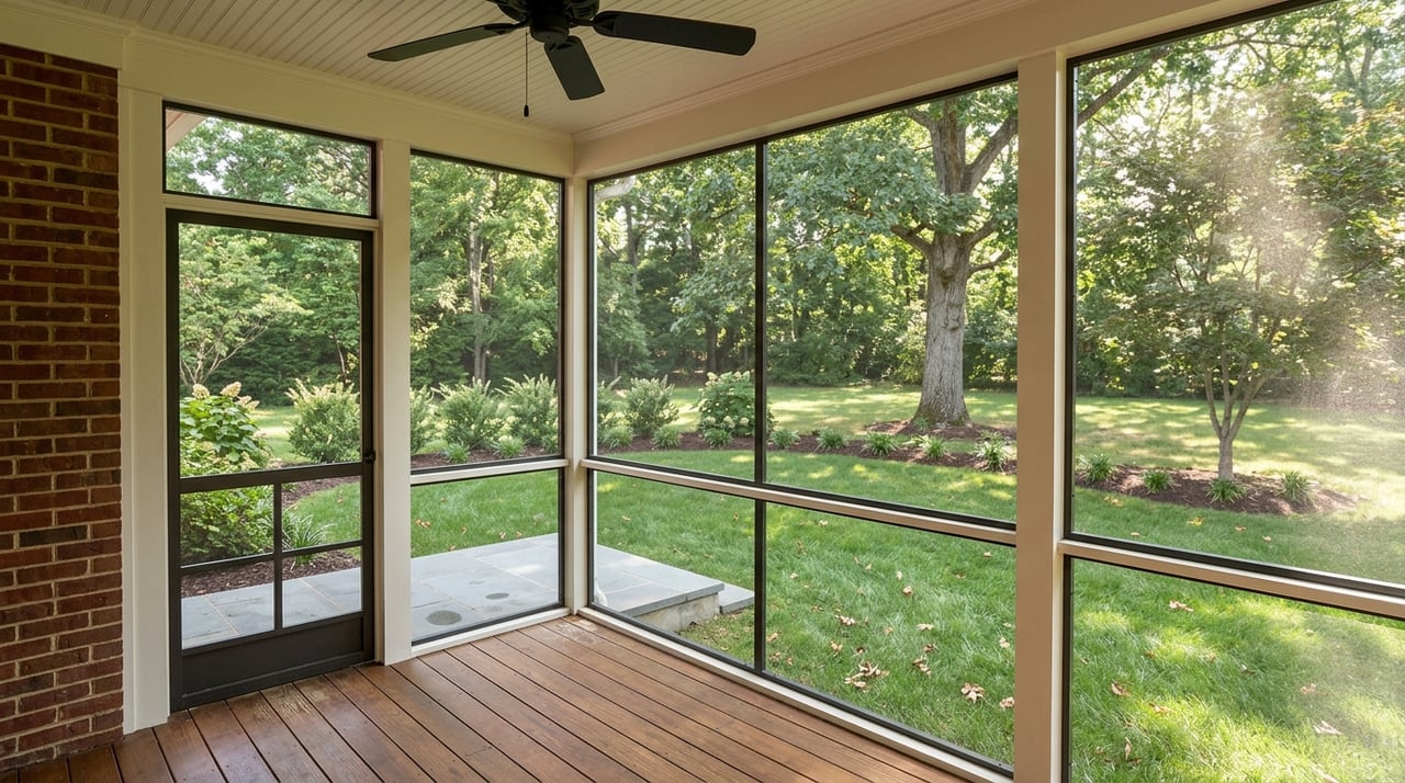
Seasonal view
- Seasonal view is clearer when leaves are off in late fall through early spring. In summer, the same sightline can be partially or fully blocked by foliage.
Panoramic or long-range view
- Panoramic or long-range means wide vistas that stretch for miles, typically from higher elevations. These are rarer and often draw strong buyer interest.
Partial, filtered, or framed view
- Partial/filtered indicates you see ridges through trees or from specific spots, such as an upper deck or a corner window.
Unobstructed or unrestricted view
- Unobstructed suggests no immediate visual barriers from key living areas. Always confirm it is not the result of recent clearing that could grow back or be blocked by future builds.
Waterfront plus mountain view
- Waterfront + mountain pairs a water feature, like a river or reservoir edge, with ridgelines. This combo is popular and may boost demand.
Why views change by season and elevation
Monroe County’s mix of valleys, foothills, and forested slopes creates big differences in sightlines. A property a few hundred feet higher than a neighbor can have a much broader outlook. Leaf-on months can filter or block views, while leaf-off months reveal distant ridges that are not visible in summer. Orientation also matters. A south-facing slope may have more sun and glare during parts of the day, which changes how a view feels in person.
How views influence price and value
Views can add value, but the premium depends on context. Appraisers rely on recent sales with similar view quality and topographic position to make adjustments. The more unique and durable the view, the more likely it is to support pricing.
Factors that can increase value:
- Unobstructed panoramas, especially at higher elevations
- Combination views, like water plus ridgelines
- Year-round visibility, not just seasonal
- Limited competition for similar lots in the submarket
Factors that can limit value:
- Seasonal views that disappear in summer
- Risk of future blockage from nearby buildable parcels
- Narrow sightlines visible only from one small area
- Photos that exaggerate scale or distance
Local premiums vary, so rely on Monroe County comps and speak with a local appraiser if view quality is a major driver for your offer.
Verify the view before you buy
Use a simple, step-by-step approach to confirm what you will actually see in each season.
1) Pre-visit desktop check
- Pull the parcel in Monroe County GIS or Assessor tools to review boundaries and elevation.
- Open Google Earth to measure the distance and direction from the home site to the nearest ridge.
- Compare aerial and historic imagery to spot tree density and seasonal differences.
2) Drive-by and public vantage points
- Approach the area from multiple roads to see how the view changes with elevation.
- Note how the view opens or closes around bends and ridgelines.
3) On-site visit across times and seasons
- Visit at different times of day to check sun, glare, and shadows on decks and main rooms.
- If the listing mentions “seasonal,” aim to visit during both leaf-on and leaf-off periods.
- Stand in the kitchen, living room, primary bedroom, driveway, and any planned building site to assess real sightlines.
- Use binoculars or a range finder to judge distance and scale.
4) Document and verify permanence
- Ask for surveys, any recorded view easements, or history of tree removal.
- Check county planning or permit records for nearby parcels that could be developed.
- Consider a professional topographic survey and an arborist evaluation if trees are a factor.
Spot photos vs. reality
Photos and videos are helpful, but they can mislead if you don’t know what to look for.
- Telephoto compression makes distant ridges look larger and closer than they are.
- Wide-angle lenses can make interiors and views seem broader.
- Time-of-day staging at sunrise or sunset adds color and contrast you may not see midday.
- Seasonal staging can feature leaf-off views that vanish in summer.
- Drone footage offers context but may understate tree cover at ground level.
Guard against surprises by comparing MLS photos with street-level and aerial imagery, and ask for raw or unedited photos from key rooms. When possible, tour during the season that matters most to you.
Buyer tour checklist
Use this quick reference before, during, and after showings.
Before the tour
- Pull the parcel in county GIS and check Google Earth.
- Note parcel and road elevation differences.
- Identify adjacent undeveloped parcels that appear buildable.
During the tour
- Stand in main living areas, primary bedroom, and outdoor spaces; note every sightline.
- Check distance and direction to the primary ridgeline.
- View at eye level and with binoculars; decide if an elevated deck is essential.
- Note the time of day, sun angle, and glare.
- If foliage is present, ask for leaf-off images or plan a return visit.
- Listen and observe for road, farm, or industrial noise and smells.
- Assess privacy from neighboring homes and decks.
- Ask about nearby approvals, plats, or rights-of-way.
After the tour
- Request a current survey and any recorded view easements or covenants.
- Consider a short topo survey if the view is a core purchase driver.
- Save your photos and measurements to support pricing discussions.
Smart questions to ask
- Is there a recorded view easement protecting the sightline?
- Are nearby parcels for sale, under contract, or planned for development?
- Has any recent tree clearing created the view, and who controls future growth?
- Is the view truly year-round or mainly leaf-off?
- Are there photos from both seasons and from second-story or deck height?
- Has a recent appraisal included a view adjustment, and what comps were used?
Local tools and pros to tap
- Monroe County GIS or Tax Assessor for parcel maps and records
- USGS topographic maps and elevation data for terrain context
- Google Earth and aerial imagery for distance checks and 3D terrain
- County planning and permitting to spot future development
- Licensed local surveyor for lot lines, elevations, and easements
- Local appraiser familiar with Monroe County view adjustments
- Certified arborist when tree health or growth could change the view
Mini glossary
- Mountain view: Visibility of nearby or distant Appalachian ridgelines.
- Ridge view: A closer, more dominant single ridge in the sightline.
- Seasonal view: Clear mainly in leaf-off months; filtered or blocked in summer.
- Panoramic/long-range: Wide vistas extending for miles from higher ground.
- Filtered/partial: View through trees or from limited locations in the home.
- Unobstructed view: No current barriers in the main sightline; verify permanence.
- View easement: Recorded document protecting a specific view area.
- Buildable envelope: Where a structure can legally be placed on a lot.
Buying in Monroe County means learning how the land and seasons shape what you see every day. When you slow down, verify the sightlines, and confirm what is likely to remain, you make a smarter offer and enjoy the view you paid for.
If you want a local, hands-on partner to help assess views and navigate the process, reach out to Robin L Skeen. You’ll get clear guidance, steady communication, and support from search to closing.
FAQs
What does “seasonal mountain view” mean in Monroe County?
- It usually means ridges are visible in leaf-off months but are partially or fully blocked by foliage in summer.
How can I tell if a “mountain view” is year-round?
- Visit in different seasons, compare leaf-on and leaf-off photos, and ask about any view easements or recent tree clearing.
Do panoramic views always cost more in Monroe County?
- Panoramic, unobstructed views often draw stronger interest, but actual premiums depend on local comps, access, and permanence.
How do I check if my view could be blocked later?
- Review nearby parcels in county GIS, ask planning or permitting about pending development, and request any recorded easements.
Can listing photos exaggerate the view?
- Yes. Telephoto lenses compress distance and make ridges look closer. Ask for raw photos and verify in person from key rooms.
Who can help me verify a view before making an offer?
- A local REALTOR, licensed surveyor, appraiser, and a certified arborist can confirm lot lines, view adjustments, and tree impacts.